Exploring Utah’s Otherworldly Landscapes
Hanksville, Utah – United States of America
Utah has always been one of my dream destinations—especially the area around Hanksville. It’s one of the few places on Earth where you can experience the Moon and Mars in the same day.
When you look at this region on Google Maps, it’s almost impossible to believe such colors and such remoteness exist in the same place. Vast, empty, silent, and extreme—exactly the kind of nature that captures the imagination.
During our road trip across the U.S. from New York to Los Angeles, we set aside extra days in Utah to explore this incredible landscape.
Planning the Adventure
Before the trip, I had watched countless YouTube videos about “Moonscape” and “Factory Butte.” They looked unreal—so much so that I knew I had to visit and photograph them myself. And the experience was everything I hoped for.
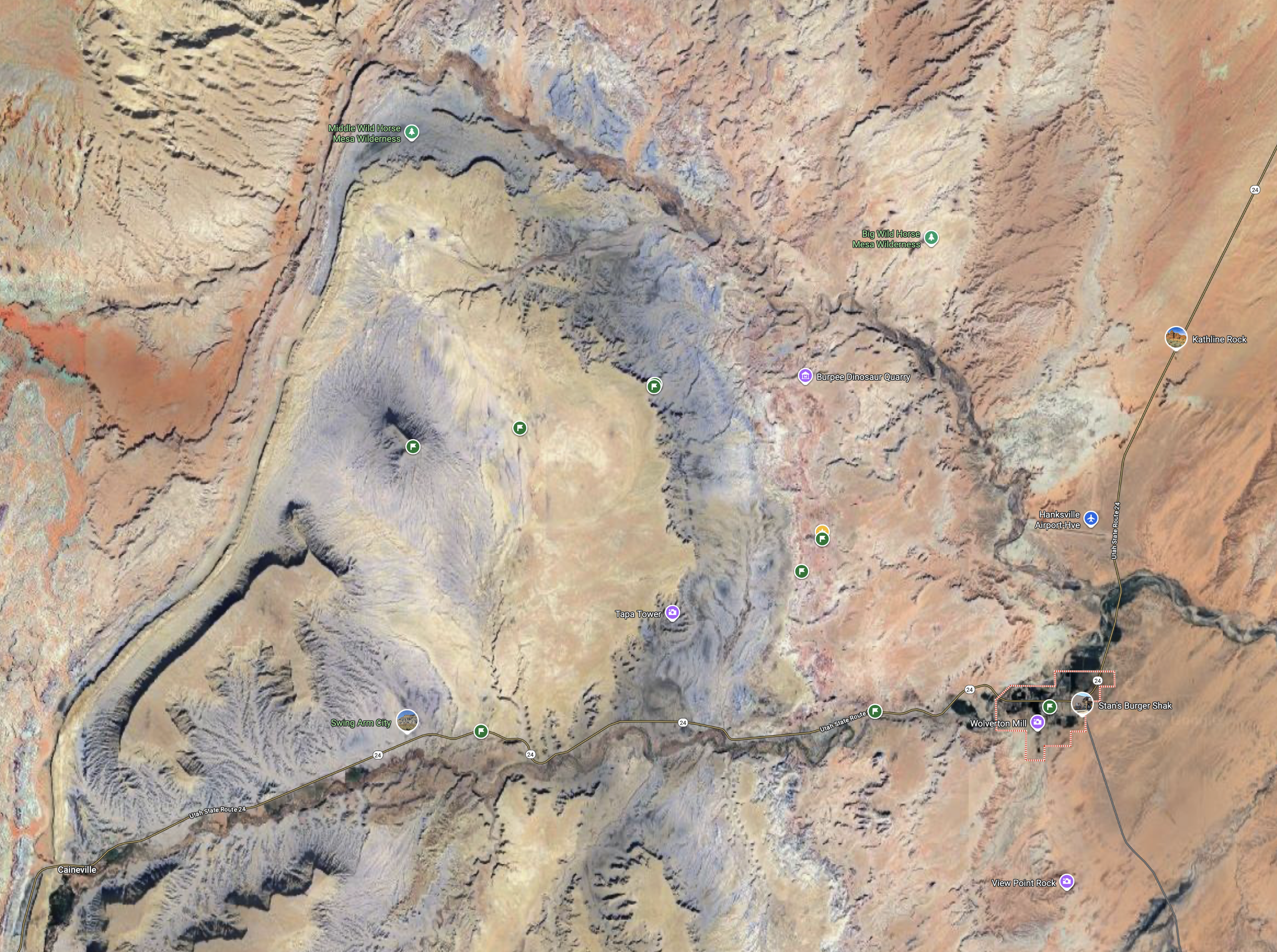
To reach the best locations, you need exact coordinates. Mark them in Google Maps so you know where to leave the pavement and head deep into the desert, far from any trace of civilization.
A drone is highly recommended—the aerial perspectives here are extraordinary.
Factory Butte
How to Get There
From Hanksville, drive west on UT-24 for 17 km (11 miles).
Turn right at 38°22'01.2"N 110°53'32.0"W.
Follow Coal Mine Road for 9 km (5.5 miles).
You’ll see Factory Butte rising in the distance the entire way. The only challenge is deciding how and when to photograph it—every angle and every hour brings a different mood.
Image Captions
Factory Butte seen from the approach road
Textures and shadows on Factory Butte’s slopes
Fact Box
Factory Butte is a 6,302 ft (1,921 m) summit in the Upper Blue Hills of Wayne County, Utah. It lies 12 miles northwest of Hanksville and about 14 miles east of the Capitol Reef National Park boundary.


Moonscape Overlook
Just 4 km (2.5 miles) from Factory Butte—still on dirt roads—you’ll reach Moonscape Overlook at 38°27'07.9"N 110°50'17.0"W. This is my favorite spot in the region.
Standing on the edge, you see a vast valley of blue, barren terrain. The road you drive on is yellowish, but the landscape below turns into a surreal lunar world—an untouched scene that feels like science fiction.
When to Visit
Best time: Sunrise for long shadows and dramatic light
Arrive early: During blue hour to capture the valley’s natural blue glow
The cliff edge is enormous, offering endless photo opportunities from both the ground and the air. Bring extra batteries—you’ll want to fly your drone for hours.
Image Captions
The sweeping view from Moonscape Overlook
Blue Valley badlands glowing at sunrise
Drone perspective revealing lunar-like textures
Fact Box:
Moonscape Overlook lies in the Blue Valley badlands, composed of Blue Gate shale. Its barren, eroded formations create a landscape often compared to the Moon.


Mars
How to Get There
Leave Hanksville west on UT-24 for 5.5 km (3.4 miles).
Turn right at 38°22'18.8"N 110°46'07.7"W.
Follow N Cow Dung Road for 6.5 km (4 miles).
Park near 38.412651, 110.783968.
The road becomes rougher here, but the journey is worth it.
Along the way, you’ll pass the Mars Desert Research Station (MDRS)—a real Mars analog habitat. The whole area looks exactly like a Martian landscape.
Walking the colorful hills feels unreal, almost like stepping on oversized popcorn—crunchy and fragile underfoot.
Get your drone in the air and have fun. This area is perfect for creative exploration.
Image Captions
Eroded Martian hills near MDRS
Drone shot of the Mars-like terrain
The Mars Desert Research Station in its surreal setting
Fact Box:
The Mars Desert Research Station is the world’s largest and longest-running Mars surface simulation facility. Built in the early 2000s, it is operated by the Mars Society and used for research and training in Mars-like conditions.


Short video from the dirt roads:
On the way to Mars !!